NavVis VLX's SLAM
"SLAM" stands for Simultaneous Localization and Mapping. This means that the mobile mapping system applies a positioning algorithm that allows it to find its own position in a map that it is creating at the same time.
The mobile mapping system measures distances based on the time it takes laser signals to travel from their source to the wall and back. It builds up the map by chaining together the many measurements that it takes while mapping. Because of this, a drift error can appear over time, which is why it's important to close loops.
To estimate its position, the mobile mapping system uses a scan match, where it compares the current laser scan to what it has "seen" before. It calculates how far and in which direction it has moved by looking at how its distances to the surroundings have changed.
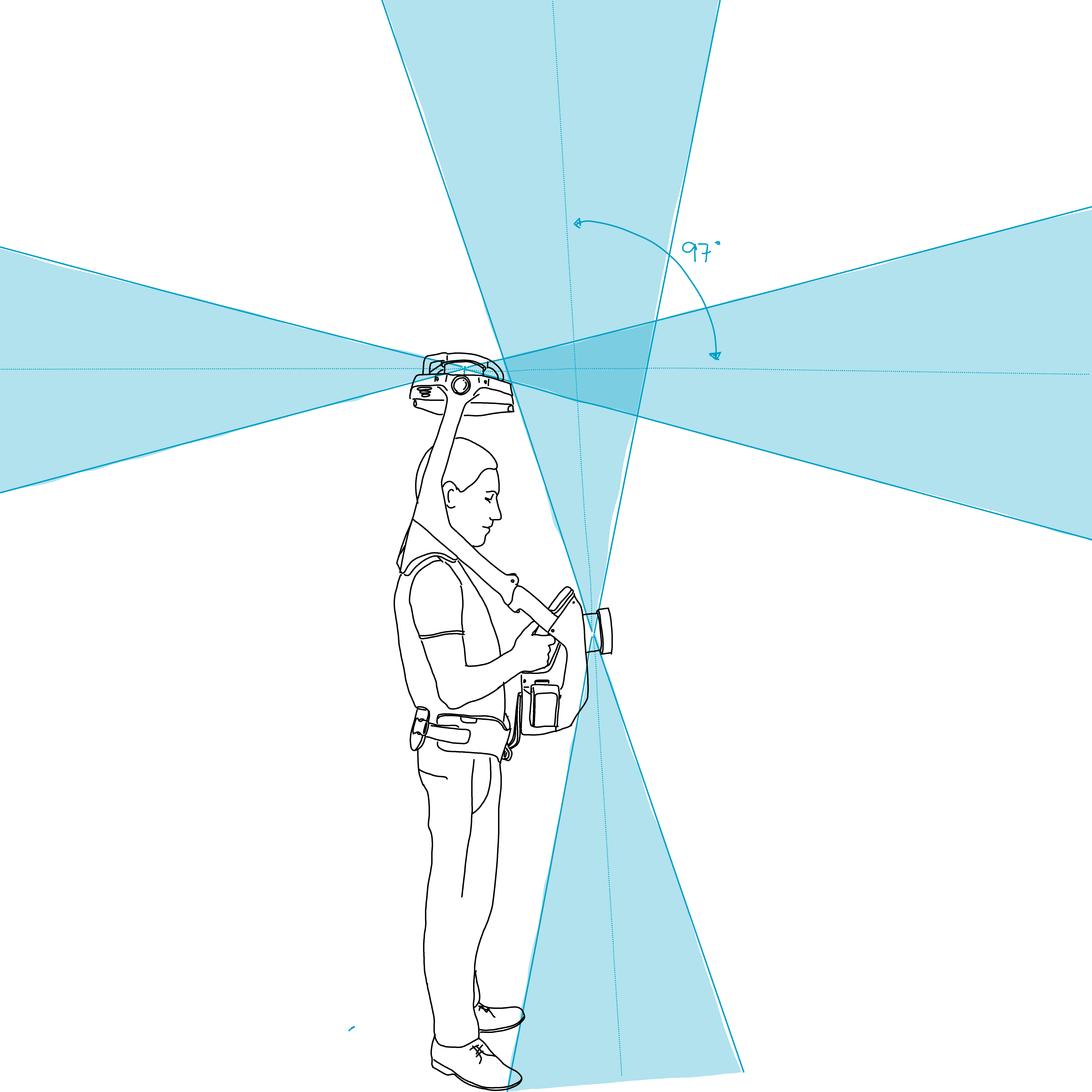
On the NavVis VLX, the data required for SLAM is captured by two laser scanners:
A horizontal laser scans in 16 layers and with a 360° field of view.
One vertical laser scans in a single tilted plane. It can scan in 16 layers and with a 360° field of view.
With this three-dimensional laser data, the VLX can not only estimate its movement in the x and y directions but also estimate changes in height (z-coordinate). The VLX is capable of 3D SLAM. That is why the NavVis VLX can handle ramps and be tilted without the localization breaking. You can even move its head up or down while mapping.
Because 3D SLAM is not constrained in the z direction, it can also drift upwards or downwards. Loop closures and SLAM Anchors compensate for this in the same way they compensate for drift in the x and y directions.